Cultural science is helping bushfire research
Cultural science integrates traditional knowledge into applied bushfire research to help New South Wales care for Country.

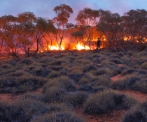
The Cultural Science team has developed a new method to advance the NSW Government's Applied Bushfire Science program by using spatial modelling to create Aboriginal heritage vulnerability maps for New South Wales. The maps will support Aboriginal communities in engaging with strategic and operational bushfire planners.
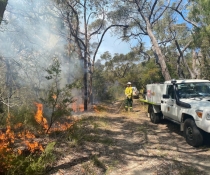
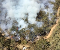
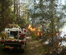
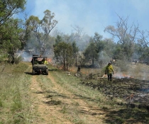
The Applied Bushfire Science program was developed to respond to and operationalise some recommendations from the NSW Bushfire Inquiry. It addresses the major knowledge gaps around risk, and appropriate fire mitigation approaches for environmental and cultural assets. It also directly supports National Parks and Wildlife Service and the Rural Fire Service with their Bushfire risk management planning process.
One of the key innovations of this program is how the Cultural Science team is working to empower Aboriginal perspectives into the planning process for fire management.
The Aboriginal heritage vulnerability maps were developed for strategic planning by Senior Cultural Scientist Shaun Hooper and Team Leader Mal Ridges. These maps collectively produce a statewide dataset and methodology to consider the risk of Aboriginal heritage to bushfire.
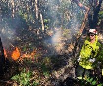
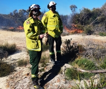
However, we also need a community-led local and regional planning process where operational decisions for fire mitigation works are made. Incorporating community cultural values from a community perspective will empower the Indigenous perspective and values into the planning process. Senior Cultural Scientist and Aboriginal Elder Graham Moore and Cultural Scientist Amanda Close, are working locally with communities on the Far South Coast of New South Wales to pilot this approach.
"Community perspectives and knowledge for Caring for Country in relation to fire, are shared through story, paintings, oral accounts by walking together on Country," explained Fire and Cultural Science Senior Team Leader, Dr Gregory Summerell.
"An example is a kangaroo skin image created by Graham, which explains country types and cultural landscapes on the Far South Coast of New South Wales.
"Many layers of knowledge and interpretation sit within this skin painting, including management of Country for fire.
"To the left of the skin painting," represents this knowledge in a traditional western mapping approach to create a cultural values map that can be shared at the fire planning table.
"If Graham went to a fire planners' meeting and placed a skin painting alongside the western maps, he wouldn't be heard as he is speaking a different language."
"Both the maps – one on skin and the other on paper – tell a similar story, but bringing them together allows the cultural ways and Western ways of communicating knowledge to come together at the one table," said Greg.
For more information, visit our Cultural science research webpage.