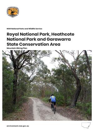
The outcome of extensive analyses, including landscape scale assessments of suitability, preliminary environmental impact assessments, and user demand, directed the selection of this location for the construction of a single-width, cross-country / all mountain bike track.
This area has also experienced increased pressure from the construction of unauthorised bike trails which have impacted on Aboriginal rock engravings and caused erosion and vegetation loss. A component of the proposed activity includes a rehabilitation plan which will address this issue by closing and allowing revegetation of these tracks, once the purpose-built track is operational.
The proposal also incorporates improvements to the western section of the Natural Bridge walking trail, which will be intersected by the proposed cycling track. This walking trail currently experiences surface issues associated with erosion, sedimentation and surface water flow. Improvements will include the installation of surface drainage structures to ensure water and sediment is dispersed along the length of the track, and also the replacement of steps (as required). Despite all best efforts it proved impossible to completely avoid passing through the Coastal Upland Swamp Endangered Ecological Community (EEC) due to its greater than anticipated distribution within the area. The track will pass through the EEC in two locations: 100 metre long section under Bluff Lookout, and a 250 metre long section which joins the new track onto the Engravings Trail.
The route of the latter section was influenced by research that showed this area of EEC has previously experienced disturbance, evidenced in the form of rubbish and weeds (which will be removed during construction). Impacts on the EEC will be minimised by the incorporation of a ‘floating’ fibreglass deck platform which will provide the best access opportunities across the sensitive vegetation community with the least impact. The track design incorporates two loops: Currie Rd/Cook St Trail (Western Loop) and the Engravings Trail (Eastern Loop) which when combined will form a track length of 6.45km. Track construction will incorporate a combination of adaptation works to sections of existing management trails (Engravings Trail and Cook St/Currie Rd trails) and the construction of new sections of purpose-built mountain bike track.
The primary objectives of the proposed activity are to:
- construct a high quality, predominantly single width sustainable mountain bike track, with a location, alignment, and design that minimises environmental, cultural heritage and social impacts;
- provide a high quality experience for beginner to intermediate-level mountain bikers to enjoy and appreciate the park;
- reduce the current impacts on environmental and natural and cultural heritage values caused by unauthorised track usage; and
- improve the safety of walkers and mountain bikers through track design and routing that, wherever possible separates these pursuits and controls excessive speed.
The new track will follow International Mountain Bicycling Association (IMBA) track standards for design, construction and maintenance, and best practice principles will be applied.
In order to minimise environmental impact and enhance the riding experience for the user, the track design and construction will:
- Where appropriate, use sections of current management/fire trails;
- Follow the contour lines where possible and use other natural features of the existing landscape, including the establishment of sustainable trail gradients that are not prone to water erosion;
- Have the same finished appearance as a bush walking trail, measuring approximately 600 mm wide; and
- Endeavour to avoid or minimise impacts (noise etc) on adjacent park neighbours and other users of the park.
The total finished track length is 6.45 km, with 2.7 km utilising existing management/fire trails and the remaining 3.75 km requiring new single track construction works.
Track construction will require some clearing of vegetation however this will be restricted to the understorey. No mature trees will be removed and the majority of works will be completed using hand tools. Impacts on the surrounding environment will be minimised through a combination of diverting the route away from vulnerable areas and the incorporation of design and construction techniques to prevent erosion, siltation and waterflow.
Appendices
Appendix A: Map of Proposed Track Location (PDF 520KB)
Appendix B: Fauna and Flora Surveys (PDF 2.5MB)
Appendix C: Heritage Assessment 1 (PDF 2.31MB)
Appendix D: Heritage Assessment 2 (PDF 1.69MB)
Appendix E: 7-Part Tests – Threatened Species (PDF 100KB)
Appendix F: 7-Part Tests – Endangered Ecological Community (EEC) (PDF 851KB)
Appendix G: Meetings (PDF 701KB) and Consultation (PDF 93KB)
Appendix H: International Mountain Bike Association (IMBA) Rules of the Trail
Appendix I: IMBA Principles of Track Design and Location (PDF 11KB)
Appendix J: IMBA Trail Difficulty Rating System


