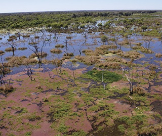
We have completed an inventory of wetlands in the Lachlan Valley, New South Wales, as a pilot study.
The aim was to develop and test a method to automate mapping and classification of wetlands which could be used to develop a statewide wetland inventory.
The method has now been verified and is ready to be deployed to build a NSW Wetland Inventory. An inventory would improve the way wetlands are monitored and managed, and make high-quality data and information available to everyone.
Results of the pilot study
The pilot study resulted in the creation of the Lachlan Wetland Inventory. In this work we:
- developed and tested a method for mapping the location and extent of wetlands
- successfully identified and mapped the extent and type of wetlands across the Lachlan River catchment
- developed guidelines to consistently map and classify wetlands
- created a roadmap for building a statewide wetland inventory
- enabled the public to access wetland information.


