Water that is allocated and managed specifically to improve the health of rivers, wetlands and floodplains is known as water for the environment.
Our environmental water management teams work with local community advisory groups including landholders, Aboriginal stakeholders, partner agencies and other interested community members to develop detailed annual plans for the use of water for the environment in each catchment, including how its use is prioritised.
Water for rivers and wetlands
Moderate rainfall and constant river flows were experienced across the Gwydir catchment during 2023–24. Major flooding occurred across the Gwydir River floodplain during March and April 2023.
Water managers used water for the environment during the 2023–24 water year to support fish communities in rivers and create connections to the Barwon River, the Mallowa Creek, and low flows into the Gingham Watercourse to fill waterholes by season’s end.
In planning for 2024–25, water managers have applied:
- a set of principles and triggers to guide the watering of key water-dependent assets
- an adaptive approach to support fish and downstream ecological connectivity.
Measures are in place to provide water for unforeseen water demands, such as extended dry periods, wetland fires and colonial waterbird nesting.
The Department of Climate Change, Energy, the Environment and Water (the department) may also set aside water for use in future years to support the longer-term resilience of the catchment through drier times.
Partnering with Aboriginal peoples
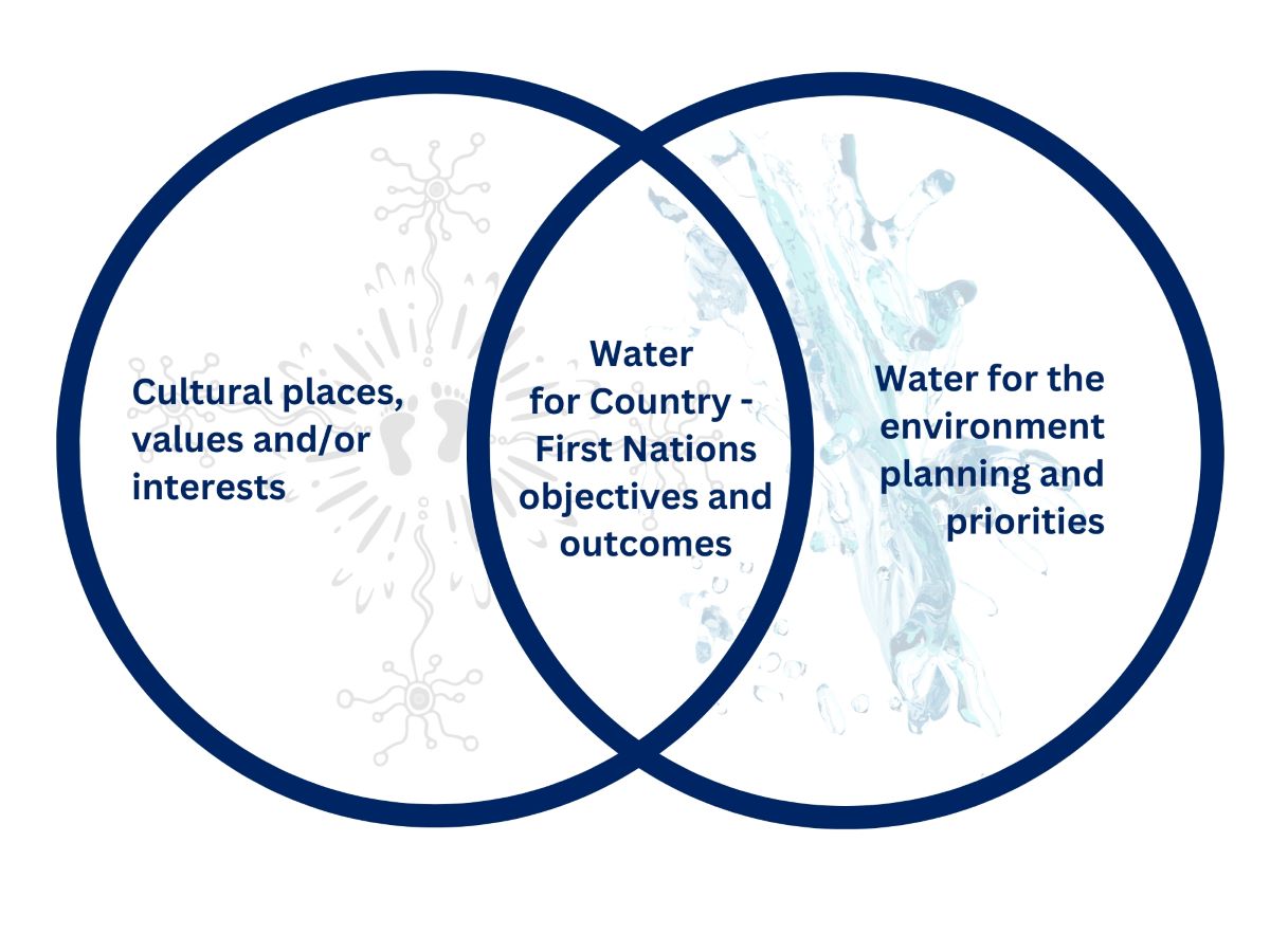
Water for Country is environmental water use planned by the department with Aboriginal peoples to achieve shared benefits for the environment and cultural places, values and/or interests.
We are working to support Aboriginal people to participate in environmental water management, programs and decision-making processes across the Gwydir catchment, through:
- support for the Aboriginal representatives on the Gwydir Environmental Water Advisory Group
- creation of the Gwydir First Nations Environmental Water Group. This group was set up to promote the views of Aboriginal communities in the Gwydir through the environmental water advisory group process and other water management programs
- partnership with the local community group OzFish Chapter, having a positive approach to connecting local community with water for the environment programs. As an ‘on Country living classroom’, OzFish engage with local Moree students at Whittaker’s Lagoon, a place of both cultural and environmental importance.
Weather and water forecast
As of June 2024, the El Niño–Southern Oscillation outlook is neutral. That is, neither La Niña nor El Niño conditions are favoured as oceanic and atmospheric indicators have returned to neutral levels. International climate models suggest neutral El Niño–Southern Oscillation conditions will persist through the southern winter, but there are some signs that La Niña conditions could form later in the 2024–25 water year.
Water managers have prepared watering plans that consider a range of weather and water availability scenarios. This is known as resource availability scenario planning.
Resource availability scenario
This table provides details about how we plan for different resource availability scenarios. Moderate to dry conditions are forecast for the Gwydir catchment in 2024–25, which means water availability planning will follow the ‘dry’ and ‘moderate’ scenarios.
Current forecast: Dry
| Conditions | Main aim | Other aims |
|---|---|---|
| Very dry | Protect | Avoid critical loss Maintain key refuges Avoid catastrophic events |
| Dry | Maintain | Maintain river functioning Maintain key functions of high priority wetlands |
| Moderate | Recover | Improve ecological health and resilience Improve opportunities for plants and animals to breed, move and thrive |
| Wet to very wet | Enhance | Restore key floodplain and wetland linkages Enhance opportunities for plants and animals to breed, move and thrive |
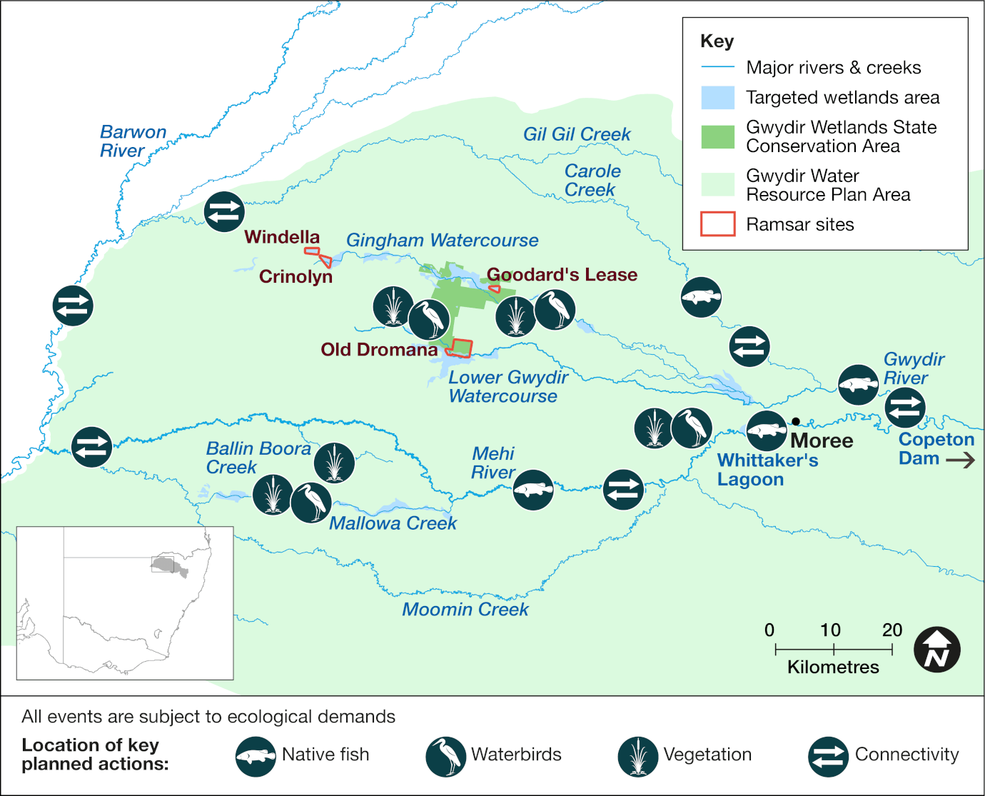
Key planned actions
Native fish
Water managers may use up to 25 gigalitres (GL) to support native fish communities. In the absence of large natural flows, a release downstream of Copeton Dam will stimulate early-season river productivity and support environmental flows later in the season.
Waterbirds
Heavy catchment rainfall, resulting in large river flows and floodplain flooding, may trigger waterbird breeding events in the wetland systems. In response, 15–25 GL of held water for the environment may be provided to support these events.
Vegetation
Water managers may use up to 20 GL across the catchment. Rainfall may trigger the delivery of held environmental water into the Mehi River, Carole Creek and/or the Gwydir wetlands system. Flows may be provided to Mallowa Creek to continue ecological improvements as part of seasonal planning for this watercourse.
Connectivity
Water deliveries for basic ecological needs in the Carole Creek, Mehi, and Gwydir rivers may occur this season if needed. The aim is to provide instream connectivity and support of native fish communities during extended dry periods. In addition to intra-catchment connectivity, water managers may consider addressing connection to the Barwon River if warranted during the year.
Map of proposed annual priority targets in the water resource plan area 2024–25
The Department of Climate Change, Energy, the Environment and Water delivers water for the environment where and when it is needed to support the health and resilience of rivers and wetlands. We use the best available science, management expertise and experience to manage water across the landscape. This statement of annual priorities identifies the waterways and wetlands that are likely to receive water.
Our decision-making process considers:
- expected availability of water in the coming year
- conditions of the previous year
- current health of the plants and animals in these ecosystems.
Water for the environment delivers benefits for communities, rivers, wetlands and wildlife across New South Wales.
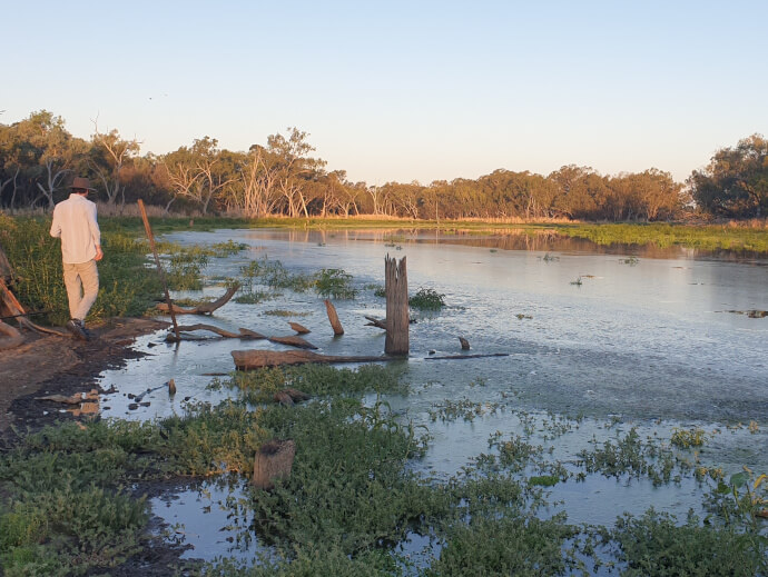
Healthy, connected rivers and floodplains are a focus for tourism, fishing, recreation and relaxation. Rivers carry water to our homes, schools, farms and businesses, and along the way, support countless species including native fish, waterbirds, frogs, plants and more. Rivers and wetlands have great cultural and spiritual significance for Aboriginal people.
Water for the environment is a critical tool to maintain and enhance the rivers, wetlands and wildlife we all love.
Working with communities
Local communities are at the heart of everything we do.
We involve the broader community by holding site tours and forums, and online and in-person events. Our local water management teams consult regularly with community-based environmental water advisory groups.
Environmental water advisory group members include local landholders, recreational fishers, Aboriginal people and local government representatives. Their advice informs the decisions made by our local environmental water management teams.
Planned environmental water
| Source | Maximum volume available (gigalitres) | Volume expected 1 July under current conditions (gigalitres) |
|---|---|---|
| Environmental water allowance | 90 | 80 |
Water licenced to New South Wales
| Source | Maximum volume available (gigalitres) | Volume expected 1 July under current conditions (gigalitres) |
|---|---|---|
| General security | 25.5 | 20 |
| Supplementary | 3 | Event dependent |
| High security | 1.2 | 1.2 |
Water licenced to the Commonwealth
| Source | Maximum volume available (gigalitres) | Volume expected 1 July under current conditions (gigalitres) |
|---|---|---|
| General security | 134.2 | 100 |
| High security | 4.5 | 4.5 |
| Supplementary | 20.4 | Event dependent |
Notes: This is an indicative summary of expected volumes to be available. For further detail and information on available volumes you can contact the region via the Department of Climate Change, Energy, the Environment and Water on 1300 361 967.
1 gigalitre = 1000 megalitres; 2.5 megalitre = 1 Olympic swimming pool.
Water for the environment has been delivering outcomes for rivers, wetlands and wildlife for 30 years.
We deliver flows that:
- trigger native fish to breed and move
- support waterbirds to nest and feed
- connect rivers and floodplains
- water forests and floodplains
- allow plants to grow, flower and set seed
- create refuge during droughts
- enhance outcomes during wetter times
- release vital nutrients from the floodplain floor that underpin the aquatic food web.
It’s habitat restoration on a landscape scale.
More information on planned and past watering events
- Annual environmental water priorities in the Gwydir catchment 2023–24
- Annual environmental water priorities in the Gwydir catchment 2022–23
- Gwydir Catchment – Water for the environment: Annual priorities 2021–22
- Gwydir catchment: Annual environmental watering priorities 2020–21
- Water for environment outcomes 2022–23
- Water for environment outcomes 2021–22