Cooks River is situated within the Sydney Metropolitan region of New South Wales. This estuary is classed as a barrier river and flows into Botany Bay near Sydney International Airport.
Most of the tributaries of the Cooks River are concrete lined drains and canals. The tidal section of the estuary is mostly flanked by mangroves, behind which lie the inner-western suburbs of Sydney and a series of recreational areas.
Water quality report card
As part of our water quality monitoring program we assess the water quality and ecosystem health of an estuary using a range of relevant indicators. We sample a subset of the estuaries located between Taree and Wollongong every 3 years. The most recent sampling in the Cooks River was completed over the 2022–23 summer, when 2 sites were sampled on a monthly basis.
This report card represents 2 water quality indicators that we routinely measure: the amount of algae present and water clarity. Low levels of these 2 indicators equate with good water quality. The numerical scores for these 2 indicators are averaged to give the overall grade.
Algae
Water clarity
Overall grade
The report card shows the condition of the estuary was fair with:
- algae abundance graded very poor (E)
- water clarity graded good (B)
- overall estuary health graded fair (C).
Grades for algae, water clarity and overall are represented as:
- A – excellent
- B – good
- C – fair
- D – poor
- E – very poor.
Go to estuary report cards to find out what each grade means, read our sampling, data analysis and reporting protocols, and find out how we calculate these grades.
We have monitored water quality in the Cooks River since 2010. This table shows the water quality grades for this estuary over that time.
| Year | Algae | Water clarity | Overall grade |
|---|---|---|---|
| 2022–23 | E | B | C |
| 2019–20 | E | B | D |
| 2016–17 | E | C | D |
| 2013–14 | E | B | D |
| 2010–11 | D | C | D |
Physical characteristics
| Estuary type | Barrier river |
|---|---|
| Latitude | –33.95 (ºS) |
| Longitude | 151.17 (ºE) |
| Catchment area | 110.6 km2 |
| Estuary area | 1.2 km2 |
| Estuary volume | 1084.4 ML |
| Average depth | 0.9 m |
Tidal exchange volume
Tidal exchange volume, or tidal prism data, is available for this estuary. This tidal prism was measured in 1990.
| Tide state | Flow (ML) | Local tidal range (m) | Sydney Harbour tidal range (m) |
|---|---|---|---|
| Ebb flow | 2,170 | 1.18 | 1.14 |
| Flood flow | 1,570 | 0.78 | 0.77 |
Notes: km2 = square kilometres; m = metres; m3 = cubic metres; ML = megalitres.
Water depth and survey data
Bathymetric and coastal topography data for this estuary are available in our data portal.
Land use
The Cooks River drains a highly disturbed catchment. It has over 90% land use disturbance, which is the highest percentage land use of all NSW rivers. The dominant land use is urban and, to a lesser extent, industrial development and horticulture. Sydney International Airport lies beside the lower reaches of the estuary.
National and marine parks
- Wooli Creek Regional Park is the largest conservation area in this catchment.
- This estuary does not flow into a marine park.
Community involvement
- Cooks River Alliance is a partnership of 4 councils dedicated to improving the health of the Cooks River. The alliance runs programs and supports volunteers who want to get involved in environmental projects. Its website includes and list of links to other community groups working to restore and protect the health and biodiversity of the Cooks River.
- Cooks River Valley Association is a community group that works to rehabilitate the Cooks River.
- Greater Sydney Landcare Network is a community organisation and an umbrella group for a host of Landcare organisations in the region. They have a number of projects listed on their website and support volunteers to get involved in work to protect, restore and improve the natural environment of Greater Sydney.
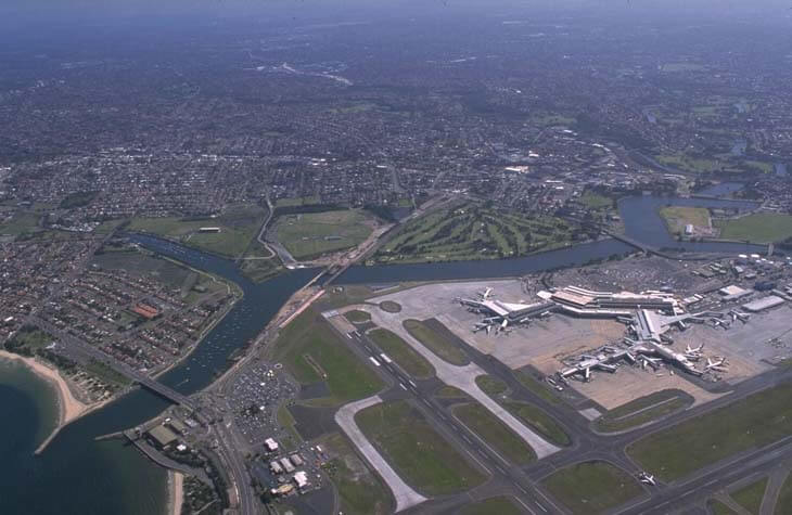
Aerial view of Cooks River
Local government management
Local councils manage estuaries within their area. Where an estuary is attached to a marine park, marine park management teams are responsible for ensuring compliance with marine park zoning.
The Cooks River flows through a number of local government areas, including Bayside, City of Canterbury Bankstown, Inner West and Strathfield councils.
Threatened species
An endangered population of long-nosed bandicoot exists in the urbanised catchment of the Cooks River.
Read more about the biodiversity in our estuaries.