Black Head Lagoon is located on the mid-north coast of New South Wales at Black Head. It is classed as a creek with an entrance that is intermittently open and closed to the ocean.
Water quality report card
As part of our water quality monitoring program we assess the water quality and ecosystem health of an estuary using a range of relevant indicators. We sample a subset of the estuaries located between the Queensland border and Taree every 3 years. The most recent sampling in Black Head Lagoon was completed over the 2022–23 summer, when 2 sites were sampled on a monthly basis.
This report card represents 2 water quality indicators that we routinely measure: the amount of algae present and water clarity. Low levels of these 2 indicators equate with good water quality. The numerical scores for these 2 indicators are averaged to give the overall grade.
Algae
Water clarity
Overall grade
The report card shows the condition of the estuary was fair with:
- algae abundance graded fair (C)
- water clarity graded good (B)
- overall estuary health graded fair (C).
Grades for algae, water clarity and overall are represented as:
- A – excellent
- B – good
- C – fair
- D – poor
- E – very poor.
Go to estuary report cards to find out what each grade means, read our sampling, data analysis and reporting protocols, and find out how we calculate these grades.
We have monitored water quality in the Black Head Lagoon since 2010. This table shows the water quality grades for this estuary over that time.
| Year | Algae | Water clarity | Overall grade |
|---|---|---|---|
| 2022–23 | C | B | C |
| 2019–20 | E | D | E |
| 2016–17 | E | C | D |
| 2013–14 | C | C | C |
| 2010–11 | B | D | C |
Physical characteristics
| Estuary type | Creek |
|---|---|
| Latitude | –32.07 (ºS) |
| Longitude | 152.54 (ºE) |
| Catchment area | 2 km2 |
| Estuary area | 0.01 km2 |
| Estuary volume | 1.4 ML |
| Average depth | 0.2 m |
Notes: km2 = square kilometres; m = metres; ML = megalitres.
Water depth and survey data
Bathymetric and coastal topography data for this estuary are available in our data portal.
Land use
The catchment of Black Head Lagoon has been heavily disturbed by urban development centred around the towns of Black Head and Hallidays Point. An area of bushland remains adjacent to the estuary, but most bushland has been cleared.
National and marine parks
- No conservation areas are located within this catchment.
- This estuary does not flow into a marine park.
Community involvement
- Manning Coastcare Group is the umbrella organisation for a set of local volunteer groups, including a group based in Hallidays Point.
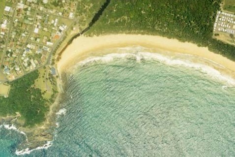
Aerial view of Black Head Lagoon estuary.
Local government management
Local councils manage estuaries within their area. Where an estuary is attached to a marine park, marine park management teams are responsible for ensuring compliance with marine park zoning.
MidCoast Council manages this estuary.
Threatened species
Small coastal creeks provide an important protected environment for saltmarsh communities to thrive.
Read more about the biodiversity in our estuaries.