Research work has been undertaken in collaboration with the University of New South Wales (UNSW), GeoQuEST Research Centre, the University of Wollongong (UOW), the Australian Government and the Australian Nuclear Science and Technology Organisation (ANSTO).
Just add water
Although the lakes still hold water, they could do with more. While the COVID-19 situation presented some barriers to fieldwork, further research was undertaken in spring 2020 and lake water levels are still monitored.
Water levels over the last 12 months
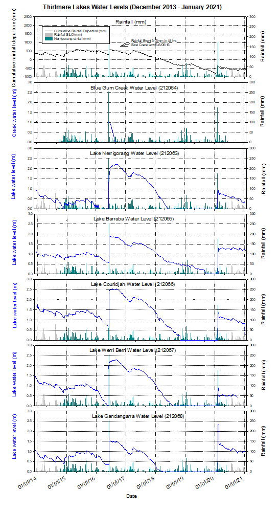
After surface water dried out at the end of 2019, the February 2020 rain event saw a rise in water levels to over one metre in most lakes. Since that time, there has been a continuing decline in water levels and the margin of the lakes are again retreating.
Lake Baraba, however, is again doing things slightly differently to the other lakes and has had relatively stable water levels for the last few months (about 1.2 m above the recording instrument). Further water samples were undertaken by ANSTO towards the end of 2020 and we now have up to 60 different field parameters, isotopic ratios or chemical analytes measured, with well over 10,000 results above detection limits.
The individuality of the lakes is demonstrated in the behaviour of water stable isotopes in each lake and the length of the hydroperiod (the time the lakes held water). Lake Baraba was the most resilient, reaching desiccation before the February rainfall events and approximately 20 months later than, for example, Lake Gandangarra (source: ANSTO). The resilience of Baraba Lake is associated with a number of unique characteristics identified in the geochemical analysis: see Water levels in Thirlmere Lakes, December 2013 to January 2021 (PNG 34KB).
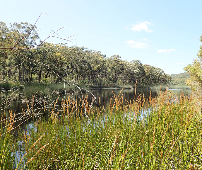
Lake Baraba, Thirlmere Lakes, January 2021 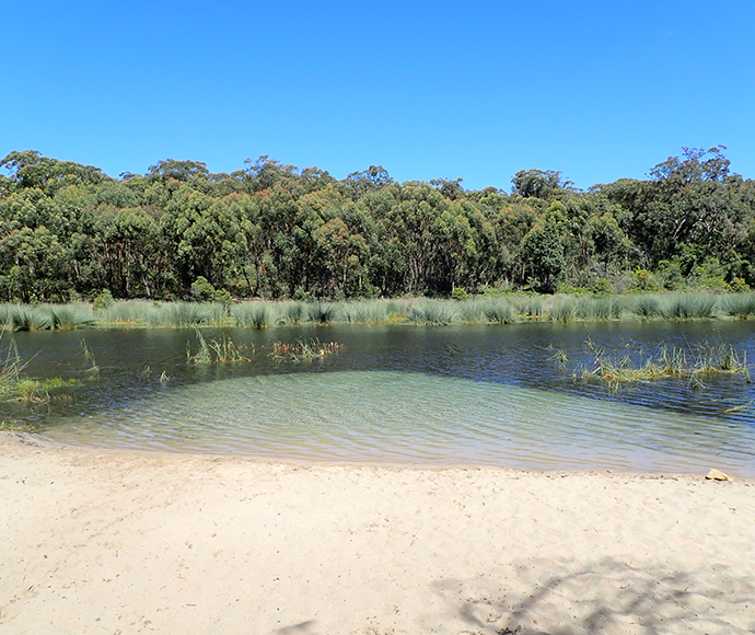
Lake Couridjah, Thirlmere Lakes, January 2021 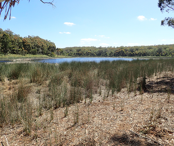
Lake Gandangarra, Thirlmere Lakes, January 2021 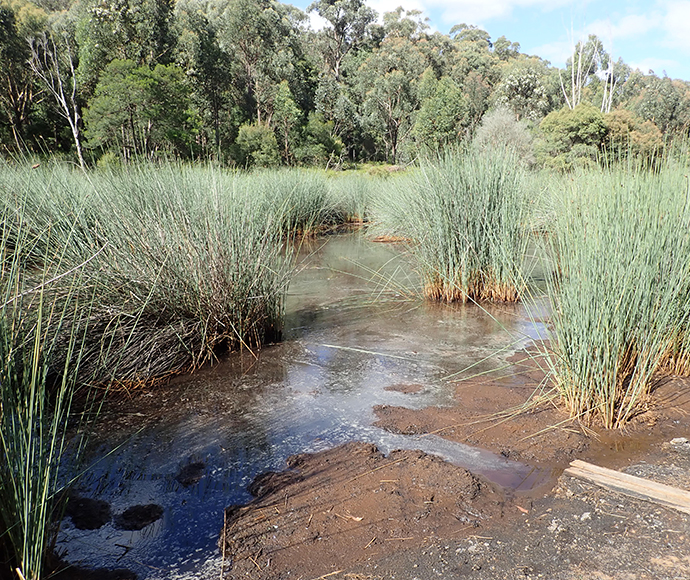
Lake Nerrigorang, Thirlmere Lakes, January 2021 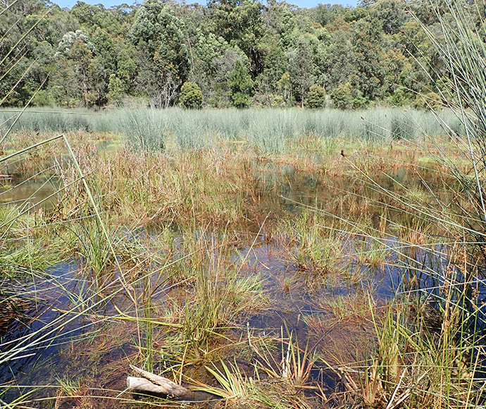
Deep drilling and seismic surveys
One of the longstanding questions in regard to Thirlmere Lakes has been exactly how deep the bedrock is underneath the sediments in the valley.
This was addressed by the University of Wollongong research team recently by undertaking some deep drilling along the Lake Nerrigorang Track and Dry Lakes Road. This was complemented by seismic surveys undertaken with the help of Drs Peter Hatherly and Christian Anibas (see map below for locations of bore holes and seismic lines).
While analysis of the cores and data collected is ongoing, the short answer is that unweathered bedrock in the valley was found at ~30–40m below ground level. The depth of unconsolidated material was greatest at the Lake Nerrigorang end of Thirlmere Lakes (30–40m; 268–282m AHD). At the Dry Lake/Lake Gandangarra sill the depth of fill was ~15m (295m AHD). A net western gradient in the underlying bedrock is suggested, presumably representing past river gradients of the valley prior to uplift and prior to the formation of the lakes. The age of valley fill within the Thirlmere lakes has been found to be at least 300,000 to 500,000 years. However, this represents an age determination at only one-third to half the depth of the alluvium and so is only a minimum age of the valley fill (source: University of Wollongong): see Location of drilling and seismic lines, Lake Nerrigorang Track, Thirlmere Lakes (PNG, 582 KB).
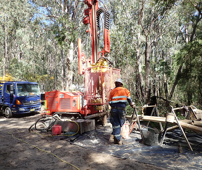
Drilling addresses longstanding questions about Thirlmere Lakes.
Citizen science verification of wetland vegetation API
As part of the wetland vegetation monitoring program, members of Friends of Thirlmere Lakes (FOTL) trialled the method in 2020 and surveyed on 21/7/20, 28/7/20, 29/7/20, 8/8/20, 12/8/20 and 12/9/20. These survey locations were mapped. The project was also uploaded onto the NSW SEED (Sharing and Enabling Environmental Data) Citizen Science Hub. As part of the survey, frog audio also recorded the common eastern froglet (Crinia signifera) on 19/6/20, 20/7/20, 21/7/20, 28/7/20 and 29/7/20.
A major finding of the wetland vegetation project identified that since 2014 terrestrial species, such as the flaky-barked tea tree (Leptospermum trinervium), are encroaching into the historically inundated area where only wetland species (for example, grey sedge or Lepironia articulata) occur. Citizen scientists may be instrumental in plotting the occurrence of this species in all the wetlands in Thirlmere Lakes.
Where to next?
Due to the ongoing COVID-19 issues, the Annual Science Day originally planned for February 2021 has been postponed to June 2021 (details will be available closer to the date). Most of the researchers have or are currently finalising their final research reports. These reports will then be peer-reviewed. The Final Report for the Thirlmere Lakes Research Program is currently scheduled to be finalised by mid-2021.