Saltwater Creek is located on the south coast of New South Wales. It is classed as a creek with an intermittently closed entrance.
The lower estuary meets the sea adjacent at the north end of a beach. The entrance to Woodburn Creek estuary is located at the south end of the beach.
Water quality report card
As part of our water quality monitoring program we assess the water quality and ecosystem health of an estuary using a range of relevant indicators. We sample a subset of the estuaries between Wollongong and the Victorian border every 3 years. The most recent sampling in Saltwater Creek (Eden) Lake was completed over the 2014–15 summer, when 2 sites were sampled on a monthly basis.
This report card represents 2 water quality indicators that we routinely measure: the amount of algae present and water clarity. Low levels of these 2 indicators equate with good water quality.
Algae
Water clarity
Overall grade
The report card shows the condition of the estuary was good with:
- algae abundance graded fair (C)
- water clarity graded good (B)
- overall estuary health graded good (B).
Grades for algae, water clarity and overall are represented as:
- A – excellent
- B – good
- C – fair
- D – poor
- E – very poor.
Go to estuary report cards to find out what each grade means, read our sampling, data analysis and reporting protocols, and find out how we calculate these grades.
Physical characteristics
| Estuary type | Creek |
|---|---|
| Latitude (ºS) | –37.17 |
| Longitude (ºE) | 150 |
| Catchment area (km2) | 17.2 |
| Estuary area (km2) | 0.1 |
| Estuary volume (ML) | 16.8 |
| Average depth (m) | 0.3 |
Notes: km2 = square kilometres; m = metres; ML = megalitres.
Water depth and survey data
Bathymetric and coastal topography data for this estuary are available in our data portal.
Land use
The entire catchment of Saltwater Creek is relatively undisturbed forest within Ben Boyd National Park. A campground has been established beside the lower estuary with an access road that cuts through part of the catchment.
National and marine parks
- This estuary is situated within the southern Green Cape area of Ben Boyd National Park.
- This estuary does not flow into a marine park.
Community involvement
- The Far South Coast Landcare Association is a volunteer environmental and conservation organisation that works to improve management of local land and water.
- The National Parks and Wildlife Service offers many ways for volunteers to get involved in environmental and educational projects in our coastal national parks.
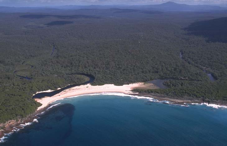
Aerial view of Saltwater Creek estuary.
Local government management
Local councils manage estuaries within their area unless the estuary is attached to a marine park. Bega Valley Shire Council manages this estuary.
Threatened species
The catchment around Saltwater Creek estuary supports habitat for the endangered striated fieldwren.
Read more about the biodiversity in our estuaries.