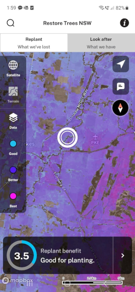
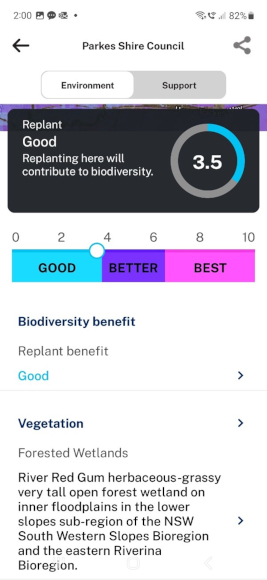
When it comes to land restoration, ‘Where should we plant?’ and ‘Where is it best to look after the bush?’ are 2 of the most frequent questions. This app provides an easy-to-navigate way to find where in New South Wales you can best contribute to biodiversity benefits. It also provides detailed environmental information and support for any NSW location.
Restore Trees NSW is designed with the land manager in mind. The app can help guide you to the best locations for landscape restoration and is of particular interest to land carers, restoration investors and participants in the NSW Biodiversity Offsets Scheme.
Download the Restore Trees NSW app to your mobile or web browser:
Android: Google Play
iOS: App Store
Web: Restore Trees NSW
Restore Trees NSW – An app for replanting and managing biodiversity
Using the app
The app can be used in the field or at your desk. Find out which native plants grow in your local area. Learn about the relative biodiversity benefits for replanting or managing local vegetation anywhere in New South Wales.
The app provides local information about plants, animals, topography, administrative and Aboriginal cultural information.
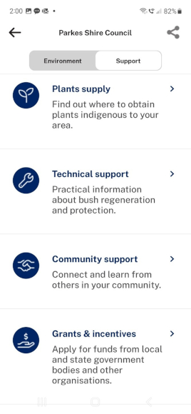
You can also use the app’s support section to help connect with a range of technical and financial support services for landscape restoration.
The Restore Trees NSW app has many potential uses, including:
- learning more about the vegetation and environment near you and anywhere in New South Wales
- finding which native plant community types and species are local to an area
- selecting an individual tree or plant and searching for pictures and descriptions
- getting in contact with the right people who can help and support your project.
Biodiversity benefits
The ‘Look after’ and ‘Replant’ maps within the app were adopted from the department’s Native Vegetation Management Benefits spatial data set.
This mapping identifies the relative benefits to NSW biodiversity of protecting or restoring native vegetation at specific locations. It is used for NSW-wide reporting on the status and trends of biodiversity, and for conservation planning.
As well as displaying a precise numerical score for a location, the app also generalises the benefits data into 3 classes (based on Jenks natural breaks method) as follows:
| 'Look after' class | Impact of looking after existing native vegetation |
|---|---|
| Good |
|
| Better |
|
| Best |
|
| 'Replant' class | Impact of replanting |
|---|---|
| Good |
|
| Better |
|
| Best |
|
The Native Vegetation Management Benefits method employs peer-reviewed ecological theory to combine vascular plant records, bioclimatic data, vegetation condition mapping and connectivity analysis.
Its layers are derived from a common set of NSW-specific inputs:
- a generalised dissimilarity model accounts for the distribution of vegetation community types
- a vegetation condition layer accounts for the state of native vegetation on a scale ranging from completely cleared to substantially intact.
Connectivity modelling is used to account for how each location connects to functioning habitat. Through an ecological model, the 3 key criteria of vegetation condition, representation of community types and landscape connectivity are combined to assess benefits to NSW biodiversity of managing or restoring at each location.
The app uses 2 spatial data layers from the Native Vegetation Management Benefits dataset (series 2): ‘Manage benefits’ is the layer used for ‘Look after’; ‘Restore benefits’ is the layer used for ‘Replant’. The spatial data layers are available through the NSW SEED data portal. The SEED record also includes a description of the data and a metadata statement.
References
Drielsma MJ, Ferrier S, Howling G, Manion G, Taylor S and Love J (2014) ‘The Biodiversity Forecasting Toolkit: Answering the ‘how much’, 'what' and ‘where’ of planning for biodiversity persistence', Ecological Modelling, 274 (24 February 2014):80–91, doi:10.1016/j.ecolmodel.2013.11.028.
Drielsma M and Love J (2021) ‘An equitable method for evaluating habitat amount and potential occupancy’, Ecological Modelling, 440 (15 January 2021): Article 109388, doi:10.1016/j.ecolmodel.2020.109388.
Drielsma MJ, Love J, Thapa R, Taylor S and Williams KJ (2022) ‘General Landscape Connectivity Model (GLCM): a new way to map whole of landscape biodiversity functional connectivity for operational planning and reporting’, Ecological Modelling, 465 (March 2022): Article 109858, doi:10.1016/j.ecolmodel.2021.109858.


