Butlers Creek is located on the south coast of New South Wales. It is classed as a small creek with an intermittently closed entrance.
Water quality report card
As part of our water quality monitoring program we assess the water quality and ecosystem health of an estuary using a range of relevant indicators.
Find out more about our estuary report cards.
Physical characteristics
| Estuary type | Creek |
|---|---|
| Latitude | –35.55 (ºS) |
| Longitude | 150.38 (ºE) |
| Catchment area | 3.1 km2 |
| Estuary area | 0.03 km2 |
| Estuary volume | 6.1 ML |
| Average depth | 0.2 m |
Notes: km2 = square kilometres; m = metres; ML = megalitres.
Water depth and survey data
Bathymetric and coastal topography data for this estuary are available in our data portal.
Land use
The small catchment of Butlers Creek is moderately disturbed with over 60% of land cleared for urban use at the Australian National University’s coastal field station, Kioloa Coastal Campus. One-third of the catchment is forest, some of which lies in Murramarang National Park.
National and marine parks
- Murramarang National Park is the largest conservation area within this catchment.
- This estuary does not flow into a marine park.
Citizen science projects
- The Budawang Coast Nature Map is an online data platform the community can use to record and identify biodiversity. Data collected is used to map the distribution of native plant and animal species from Moruya up almost to Kiama.
- The South Coast Shorebird Recovery Program provides the opportunity for people to get involved in the protection and recovery of shore birds.
Community involvement
- The Shoalhaven Landcare Association represents a range of volunteer groups working in and around the Butlers Creek catchment.
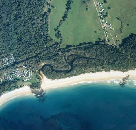
Aerial view of Butlers Creek estuary.
Local government management
Local councils manage estuaries within their area unless the estuary is attached to a marine park. Butlers Creek estuary is managed by Shoalhaven City Council.
Threatened species
Butlers Creek estuary supports a number of native plants and animals.
Read more about the biodiversity in our estuaries.