Discovering the secrets of Kosciuszko's contour terrace formations
How scientists are helping to protect some of Australia's rarest and most unique landscapes.
What are contour terrace formations?
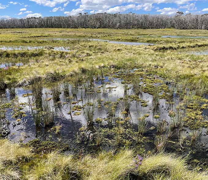
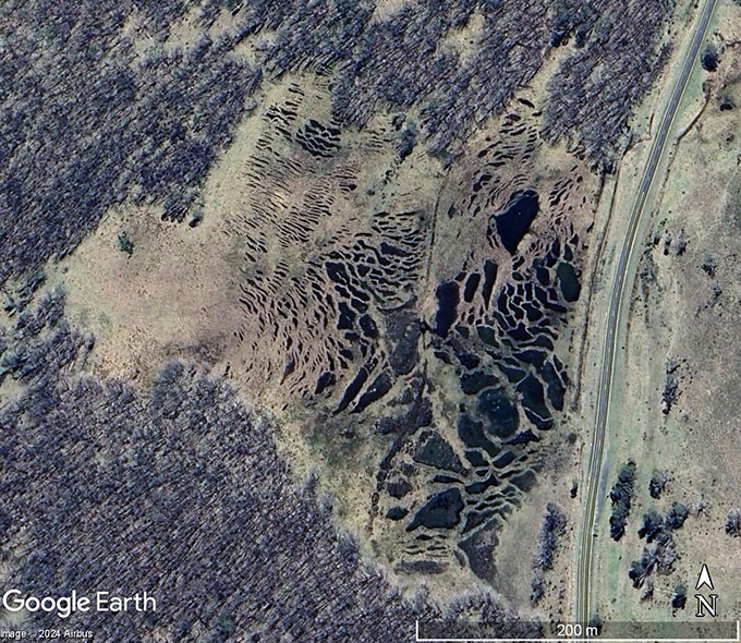
Contour terrace formations are a repeating pattern of shallow ponds separated by low, narrow levees. They look like a series of rice paddies on a slope. They are found in the high plains of the northern part of Kosciuszko National Park, including Tantangara, Long Plain and Gooandra.
These formations are very rare and unusual. Apart from Kosciuszko, they only occur in a few places in the southern hemisphere, such as:
- some high plains and plateaux in Victoria and Tasmania
- Macquarie and Heard Islands
- the very southern tip of Tierra del Fuego.
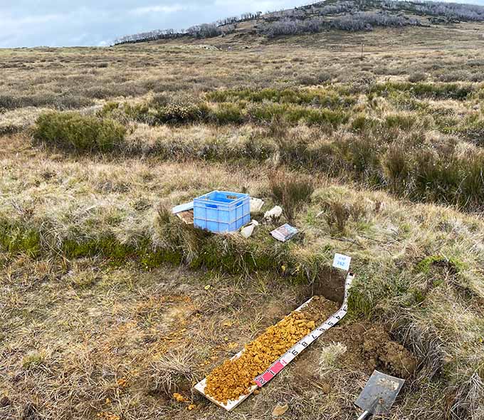
Scientists from the Soil and Landscape Assessment Team are studying these formations to understand how they form and why they matter. This is part of a broader 5-year program to map the soils and landscapes of the park in detail for the first time.
How do they form?
Contour terrace formations are not ancient relics of a colder climate. They are a result of modern processes. The key factors are the soil and surface moisture and the growth of certain plant species.
Mosses and cushion plants, such as Coprosma nivalis, make up the 'bolster' heath plant community. They produce their own highly organic soils. However, these plants can die when there is too much water in the poorly drained ponds. To survive, the plants extend upwards and outwards, searching for the right amount of moisture. As they do this, they form levees made of their own organic material. These levees create the right conditions for the plant communities to keep growing.
When there are large amounts of water flowing through the system, the levee walls overflow and cause the system further down the hill to reset. This produces the connected downslope curved pattern visible on aerial photos.
Why do they matter?
Contour terrace formations are an important indicator of landscape stability and climate change. They have a very limited and specific distribution in Kosciuszko National Park, making up only a small portion of the park. However, they provide important habitat for a range of semi-aquatic plant and animal species. They are also highly susceptible to damage from feral pests in the park.
The Soil and Landscape Assessment Team scientists are looking to understand these unusual landscape formations better. The team's next steps will be to:
- map the distribution of contour terrace formations throughout the park
- determine their topographic and microclimatic limits
- analyse soil and vegetation data to identify the key contour terrace-forming plant species.
Documenting this information will ensure these unique landscapes are protected and managed sustainably in Kosciuszko National Park into the future.