Hazard reduction burn in Pilliga Nature Reserve
The NSW National Parks and Wildlife Service (NPWS) is planning to conduct a hazard reduction burn in Pilliga Nature Reserve, beginning Monday 27 May, weather permitting.
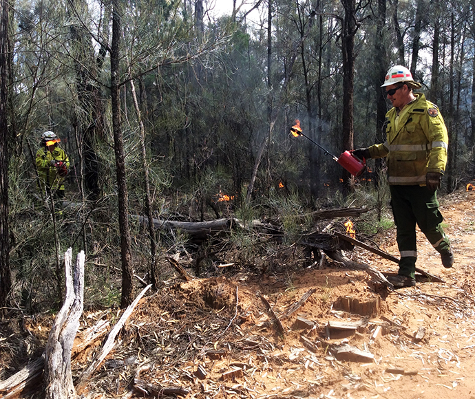
The 1,240 ha burn will utilise both ground and aerial ignition and is expected to take five days, with burning undertaken in 2 stages.
The burn aims to reduce fuel loads on the southern boundary of the nature reserve to create a fire break, which may help to reduce the intensity and spread of future wildlfires.
Sandstone Caves Visitor Area, Yaminba Trail and Redbank Trail will be closed to visitors for the duration of the burn.
There is no public vehicle access to Pilliga Nature Reserve, however the Newell Highway may be impacted by smoke depending on wind conditions. Motorists are advised to use caution and drive to conditions.
Smoke may be visible to residents in Coonabarabran, Bugaldie, Baradine and Rocky Glen. People vulnerable to smoke are encouraged to stay indoors and keep doors and windows closed to reduce exposure.
Hazard reduction burns are essential to reduce bushfire fuel loads to help protect parks, neighbours and communities from future bushfires.
This burn is one of many hazard reduction operations undertaken by NPWS each year, many with assistance from the Rural Fire Service and Fire and Rescue NSW.
All burns around the state are coordinated with the NSW Rural Fire Service to ensure the impact on the community is assessed at a regional level.
People with known health conditions can sign up to receive air-quality reports, forecasts and alerts via email or SMS from the Department of Climate Change, Energy, the Environment and Water. For health information relating to smoke from bushfires and hazard reduction burns, visit NSW Health or Asthma Australia.
More information on hazard reduction activities is available at NSW Rural Fire Service and the NSW Government's Hazards Near Me website and app.